Showing posts with label Gulf Intracoastal Waterway. Show all posts

Our Top 10 Anchorages


When we were asked to pick our 10 favorite anchorages, it felt like trying to decide which child you like best. So our criterion was holding, protection, things to do ashore, beauty and location. Some don’t meet all of these, but they cover the range of things we look for in an anchorage. The following are a good sampling of some of our favorites and we hope they will be yours too.

The Ultimate Tribulation

By Chuck Baier

Today's blog post will be more of a personal nature rather than another boat related post. I hope you'll bear with me as I get my thoughts down to let everyone know what's going on, and for my own therapeutic value. The big story is near the end if you want to skip right to it. I will bring you up to date first on where we are and how Beach House and crew finally arrived after a long and difficult struggle to make our current destination. If you have been following our recent posts, you know that we had been in Carrabelle for a couple of months trying to cross the Florida Big Bend to get over to the west coast of Florida. Beach House finally made the crossing, albeit short one of her regular crewmembers.

The Third Time Isn't Always a Charm

We have been delayed so long that our friends that were way behind us finally caught up. Our next weather window looked so perfect it was scary. The two previous attempts to cross the Gulf of Mexico from Carrabelle to the Steinhatchee River had met with failure. Once because the weather forecast was not what it was supposed to be and the second time due to engine problems. So it was with a certain amount of anxiety that we began attempt number three. What is it that is said about the third time being a charm? Our friends would be accompanying us along with another boat and couple we had met along the way. How perfect could it get? Well, not so much.

The Best Laid Plans

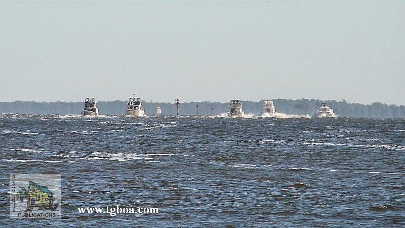
After 10 days in Apalachicola and a great Thanksgiving celebration with all of the other boaters, the break we had all been waiting for finally came. The gale force winds in the Gulf subsided, the waves returned to manageable levels, the rain stopped and the sun finally came back. On Friday morning there was a mass exodus as the parade of vessels made their way under the highrise bridge and out into St. George Sound. The faster boats quickly disappeared on the horizon and the more conservative boats stayed in the marked channel, avoiding any shortcuts. Beach House has never been known for rigidly following every channel unless there is no other choice. While some boats added miles by transiting all the way out the Apalachicola approach channel, we turned off and headed across the Bay, shaving several miles off the day's run. If there is enough depth for our draft, we will take any shortcut available.

Thanksgiving, Boater Style

About the only negative of our lifestyle, living on our boat and the freedom to travel wherever we want, is that occasionally we're away from our family on holidays like Thanksgiving and Christmas. Such was the case this Thanksgiving. We have been sitting at the dock in Apalachicola, Florida for almost two weeks waiting for the right weather window to cross the Gulf of Mexico and the Big Bend region of Florida. We had hoped to be farther along and be able to spend this holiday with family. It was not to be, but just because we aren't able to spend the time with our first family, doesn't mean we can't enjoy the holiday with our boating family. For this Thanksgiving, the traditional dinner turned out to be a rather large gathering.

A Chilly Florida

Whoda thunkit. Here we sit in Apalachicola, Florida, waking up to temps in the 30s and overnight freeze warnings. The winds have been howling out on the Gulf of Mexico and the seas have been way up, keeping us sitting at the dock for over a week. It only seems like a few days since we left Demopolis, Alabama and retraced our steps back to the Gulf Coast. The reality is that it has been 18 days and we have only covered 465 miles. Under normal circumstances, we could easily do twice that many miles in the same amount of time. To get where we are today required us to transit two locks, visit nine anchorages and free town docks, spend three nights at a marina in Alabama, one night at a friend's dock in Panama City, three nights waiting for weather at the docks at White City and spending a week here in Apalachicola. And it looks like we may be here for another week.

Part 2 - Anchoring in the Gulf Intracoastal Waterway – Cape Sable, FL to Mobile, AL

Taken from The Great Book Of Anchorages, Cape Sable, Fl to Mobile, Al, including the Okeechobee Waterway..

The Big Bend–Crystal River to Carrabelle (Mile 46 to Mile 164)
Many boats, especially those with deeper drafts, use Anclote Key as their jump off or arrival point from the Carrabelle area. Even we used to be under the impression that the Big Bend region was only for shoal-draft boats, but it really isn’t. The main thing you have to contend with is the distances in from deeper water to the river entrances, usually about 10 miles. Then add another 10 miles or so to the anchorages.

Part 1 - Anchoring in the Gulf Intracoastal Waterway – Cape Sable, FL to Mobile, AL

Taken from The Great Book Of Anchorages, Cape Sable, Fl to Mobile, Al, including the Okeechobee Waterway...

A very different kind of cruising awaits the boater traveling on the Gulf Coast. For starters, there is no one system for keeping track of the mileage for the various legs of the journey. Each section, the Southwest Florida Coast, the Gulf Intracoastal Waterway (GIWW), the Big Bend and the GIWW East of Harvey Lock (EHL–the distance east of Harvey Lock in New Orleans), has their own method–the Statute Mile is given in two of the sections and the other two use distances between waypoints/markers, leaving you to calculate the miles (which we have done for you). The biggest difference for us on the Gulf Coast is the beaches. With a few exceptions, you are generally traveling right along the coast, either just inside barrier islands or hopping from one island or river entrance to the next. And what could be more wonderful than always being close to the beach?

We begin coverage of Gulf Coast anchorages in Cape Sable, FL mainly because the major guide books and chart kits do this as well and you will be using them together. Although some of you will be Loopers using the book, you’ll simply need to work your way from back to front.

The Fantastic Journey Continues

The run from Apalachicola to the docks at White City is a short one. There were a couple of potential anchorage spots we wanted to check out, including one that was a regular for us on our sailboat, Sea Trek. The White City docks are located in a basin surrounded by a park with a boat ramp. There has never been a lot of activity here whenever we have visited. The dock next to the pavilion was under repair and closed off with caution tape. There are 20 amp outlets at the pavilion that can be used for limited power. A new floating dock has also been added on the canal front. The floating dock is better for deeper draft boats since depths along the fixed docks are 6 feet or less. There is a 24-hour limit at the docks, but if bad weather is in the area, a longer stay would not be a problem. A short walk down the road to the east brings you to a gas station and convenience store with basic staples. This is a favorite stop for us and most other boaters that pass this way. But we did find a problem on board that needed our immediate attention.

Revisiting The Florida Panhandle

It would seem that the Gulf of Mexico in the vicinity of the Steinhatchee River has it's own weather system. For a week we watched as the reports from almost every other location showed light winds and quiet conditions. Yet all of the forecasts and buoy reports for the area we needed to transit to get to St. Marks had winds and seas more uncomfortable than we prefer to travel. A long time ago we came to the conclusion that the shallow waters of the Gulf can develop some nasty waves without a lot of wind. The constant forecasts of 15 to 20 and buoy reports confirming winds kept us in the Steinhatchee much longer that we would have liked. Even on the day of our departure, the morning brought winds of 15 knots directly from the direction we had to go. We patiently waited and checked the buoys every hour until they showed wind had dropped to 10 knots. Beach House and crew was underway. The conditions were not ideal; there was still a very sloppy sea for us to plow into for a few hours. As the day progressed and we moved away from the Steinhatchee and Keaton Beach, things began to settle down and eventually the seas flattened and the winds dropped below 5 knots. Finally we were experiencing the Gulf at its best.

Exploring Florida's Gulf Coast

For a couple of days, thunderstorms have rumbled all around us, keeping us from our next destination some 50 miles to the north. This isn't like the protected waterway; this time we need to cross the Gulf of Mexico from Steinhatchee to St. Marks. "How did you get to Steinhatchee, you were just in Fort Myers," you might ask? That's a good question and one we ask ourselves. The time seems to be flying by and we are covering a lot of ground, err, water. Up until a week ago, the weather was cooperating, the boat was running just fine after the repairs and all was right with the world. After Fort Myers, there were days when we only traveled 10 to 15 miles along the waterway. But that was by design.