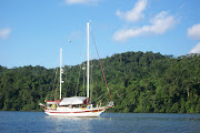
Taken from The Great Book Of Anchorages, Cape Sable, Fl to Mobile, Al, including the Okeechobee Waterway...
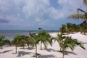
A very different kind of cruising awaits the boater traveling on the Gulf Coast. For starters, there is no one system for keeping track of the mileage for the various legs of the journey. Each section, the Southwest Florida Coast, the Gulf Intracoastal Waterway (GIWW), the Big Bend and the GIWW East of Harvey Lock (EHL–the distance east of Harvey Lock in New Orleans), has their own method–the Statute Mile is given in two of the sections and the other two use distances between waypoints/markers, leaving you to calculate the miles (which we have done for you). The biggest difference for us on the Gulf Coast is the beaches. With a few exceptions, you are generally traveling right along the coast, either just inside barrier islands or hopping from one island or river entrance to the next. And what could be more wonderful than always being close to the beach?
We begin coverage of
Gulf Coast anchorages in Cape Sable, FL mainly because the major guide books and chart kits do this as well and you will be using them together. Although some of you will be Loopers using the book, you’ll simply need to work your way from back to front.
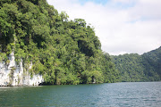
Southwest Florida Coast – Cape Sable to Sanibel (Mile 114 to Mile 4) East and Middle Cape Sable will be your first possible stops on your way north from Moser Channel, if you came by way of Marathon in the Middle Keys. They are pretty much open roadsteads so will only be an option in settled weather or in winds from the east. Your next best bet for more protection is the Little Shark River, some 17 miles north. Some folks use the Little Shark as a hurricane hole, as one can travel many miles with good depths. Next north are the anchorages in Russell Pass at Indian Key– beautiful and protected–or the great beach anchorage on Panther Key’s west side.

Some of you will be able to take the inside route north to reach the Marco Island area, if you draw 4-5 feet and can pass under the 55-foot bridge. If so, you have a few more anchorages available to you. In Gullivan Bay, take Coon Key Pass into the well-marked channel that runs through Goodland, then west under the 55-foot bridge connecting Marco to the mainland. There are some good spots to drop the hook in and around Goodland, then a few more in Factory and Smokehouse bays in Marco. If your draft will not allow you to take the inside route, you’ll need to take the long trek out and around Cape Romano, then back into Capri Pass to access these last few.

Not many boats can safely travel the shallow waters between Marco and Naples on the inside (the Old ICW), so most of you will have to head back out into the Gulf for the short trip to Naples. For very shallow-draft vessels, however, there a couple of cool spots near and behind the barrier island of Keewadin. Naples offers some anchoring choices relatively near their well-appointed town–a couple close to the Gordon Pass entrance and the other near Doctors Pass. Next heading north will be the Ft. Myers Beach area. A mooring field blankets much of the harbor, but you can still find a spot to anchor among the permanents boats farther down the harbor. There is also a good overnight spot outside in San Carlos Bay. Or, try anchoring in the lee of Sanibel, south of the bridge, for those of you with deep drafts who want an easy in and out stop.
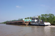
The Gulf Intracoastal Waterway (GIWW)–Merwin Key to Anclote Key (Mile 2 to Mile 151) The next area north is the Gulf Intracoastal Waterway which starts at Statute Mile 0 at the mouth of the Caloosahatchee in San Carlos Bay. This is also the end (or beginning if you’re headed east) of the Okeechobee Waterway. Those anchorages will be covered separately in their own section at the end of the book. Sailboats will need to come through the high-rise bridge at Punta Rassa to access the GIWW at Statute Mile (SM) 0, however powerboats can proceed to the west near Pt. Ybel, pass under the 26-foot bridge, then travel along Sanibel to enter the GIWW at around SM 3.

The first 25 miles of the GIWW has so many anchorages, you could spend days or weeks just gunkholing here. They start as soon as you enter the waterway with some fair weather anchorages at Merwin and Picnic Islands, St. James City or the large basin off Sanibel’s J.N. “Ding” Darling Wildlife Refuge. Next, try the protected anchorage in Roosevelt Channel on Captiva. As long as there aren’t strong southerly winds, the south end of Cayo Costa is a beautiful spot to walk on those white sand beaches looking for shells. Need more protection? Continue on and anchor in Pelican Bay near the park docks and ranger station. You can also anchor around Useppa Island to the east or west, then Charlotte Harbor is next on your itinerary. Although it is a long trek northeast from the GIWW (approximately 20 miles), many folks can’t pass Punta Gorda without stopping. The anchorage is very open to the east and west, but all feel it is worth the journey. There are a few more stops in the harbor as well.

Back out on the GIWW, a short trip across Charlotte Harbor brings you to Gasparilla Sound and Island. Enter via the well-marked channel to the west into the area marked “Yacht Basin” on the chart. You can either anchor beyond the marina to the south or take the narrow, deep channel north into a lovely, mangrove lined cove and anchor, tying your stern to the mangroves to avoid swinging into the basin or drop a stern anchor. There’s also a free day dock there to access town. This is a beautiful place with a lush golf course and high-end homes and resorts. If you have no need to go ashore or just need a quick stop, the 5-10 miles between SM 30-40 afford you a number of opportunities. Try Peekins Ranch Cove near the north end of Gasparilla Island, the area between the railroad and bascule bridges, the park area just north of the bridge, or any number of spots between Cape Haze and Don Pedro Island.
You will then enter Lemon Bay just before SM 40 where another group of great anchorages await. Thorton Key lies just next to Stump Pass for those of you desiring quick access to the beach or fishing. If you need a bit more protection, continue on to Englewood Beach to anchor in the channel that runs behind Manasota Key. If you’re in need of provisions, the mainland side anchorage near Englewood is your next choice. Walk to the nearby grocery store. There are no anchorages for the next 10-15 miles between SM 45 and 57. Your next opportunity to anchor will be in Venice. Over the years, Venice has gotten a reputation for being unfriendly to cruisers, but a local who has been visiting the free day dock there for the past 30 years told us that he has never been bothered or harassed by anyone and even stays overnight there on the dock. Your best bet might be to find a place to anchor for the night near the permanently moored boats after visiting the day dock, but remember, it is not a no-wake or even slow-speed zone and you are likely to get waked. The anchorage lies fairly close to the GIWW.

Between here and Sarasota, SM 58-73, the anchoring possibilities are once again fairly limited. You’ll have one in Blackburn Bay, where you can pull off to the west in 6 feet of water, or one in Little Sarasota Bay, also with about 6 feet at MLW. Deeper draft boats will have to wait until arriving in Sarasota proper. Your decision about where to anchor in Sarasota will be dictated by what you want to do while in the area. If you need to provision or want to visit the Ringling Brothers Museum, you’ll probably want to anchor on the mainland side for easier access to downtown. If you want to shop and dine, try the anchorage at Lido Key for the shops and restaurants on St. Armands. If you want to get away from it all, there are anchorages in and around Longboat Key that will fit the bill. The west end of Longboat Key and the area around the Cortez Bridge provide another group of anchorages with access to beaches, restaurants and shops. If you need good protection for coming weather, try the anchorage in Bimini Bay inside Anna Maria Key with great depths.

Now you have reached Tampa Bay. A short hop to the east brings you to the mouth of the Manatee River. There are a number of great anchorages here, including the one just around the corner at DeSoto Point or the free dock and neighboring anchorages in Bradenton. Terra Ceia Bay just to the north of the Manatee River is accessed by going back out into Tampa Bay, then entering through a winding, but well-marked channel to a quiet, uncrowded area for exploration. Those in need of an urban experience will want to continue north in Tampa Bay to the St. Petersburg area. You can anchor just outside of the north basin to the south or north with a short walk to everything you could want or need. If weather is moving in, head south into Big Bayou or around into Boca Ciega Bay’s multitude of anchorages and take the bus to St. Pete.

Boca Ciega has practically endless anchoring opportunities. Mud Key Channel takes you back to a very protected anchorage just across the road from the beach. The anchorage off Gulfport is not very protected, but gives you access to a great little town. Good restaurants and shops are right off the waterfront. A short distance down the waterway takes you to Paradise and Treasure Islands. This is a great stop if you need to provision, as the grocery store’s dinghy dock is just a short distance away. Another well-protected anchorage lies hidden behind Johns Pass in a basin to the south with room for a few boats. Redington Shores is a nice spot off the waterway to spend the night, provided you aren’t disturbed by water-skiers.
Then you pass through The Narrows at Indian Rocks Beach, where you can tie to the free day dock for a few hours, then move on in the evening to one of the anchorages in the Clearwater Harbor area. The anchorage next to Belleair Causeway has good easterly protection and shore access. Clearwater Beach also has a great free day dock in Mandalay Channel just across the street from the Gulf. You can tie here for the day to run errands and dine on the beach, then drop back across the channel and anchor for the night.

Traveling a little farther north brings you to the end of this section of the GIWW. Three Rooker Bar is not much more than a sandbar with bushes, but what a great spot to unwind. Just to its north is Anclote Key and Anclote River. Anclote Key is good for fair weather, whereas you may want to find a spot in the river anchorage if any foul weather is moving in. Tarpon Springs, upriver, doesn’t really have any anchorages to speak of, but you may want to stop here nonetheless, especially if you are a Greek food aficionado.
Part 2 will continue along the Big Bend region, Florida Panhandle and portions of Alabama.


No comments:
Post a Comment
Note: Only a member of this blog may post a comment.