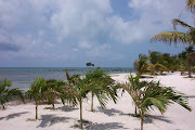
The mechanic at Dockside Marina in Carrabelle did an excellent job getting Beach House back in operation. After our 4-hour tow back to the marina from the Gulf of Mexico, and a quick phone call to the mechanic, Eric arrived early the next morning. We were concerned with letting the engine sit, even overnight, with water in the cylinders and oil pan. There wasn't much that could be done about it on such short notice and just getting someone on board by the next day was better than we expected. Not knowing how serious the problem was made for a fitful sleep that evening. Whenever something like this happens, you always expect the absolute worse and have expectations of major expense and delay. When you live on your boat full time and don't have a place to go ashore when these things happen, it makes the anxiety even stronger.
The Third Time Isn't Always a Charm
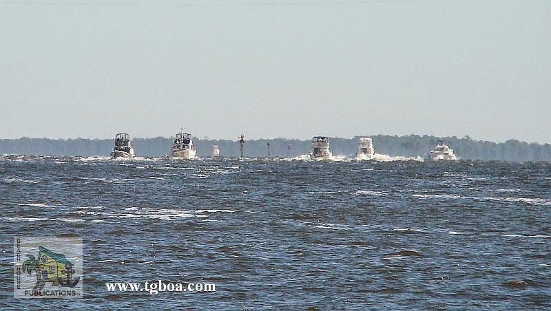
We have been delayed so long that our friends that were way behind us finally caught up. Our next weather window looked so perfect it was scary. The two previous attempts to cross the Gulf of Mexico from Carrabelle to the Steinhatchee River had met with failure. Once because the weather forecast was not what it was supposed to be and the second time due to engine problems. So it was with a certain amount of anxiety that we began attempt number three. What is it that is said about the third time being a charm? Our friends would be accompanying us along with another boat and couple we had met along the way. How perfect could it get? Well, not so much.
Boardings On The Water. What Are My Rights?
Keep in mind that we are not attorneys nor do we have any expertise in the laws regarding these actions. Every Skipper must make their own decsions when they find themselves in a boarding situation. The following are only our thoughts and opinions. Boardings by law enforcement officers on the water have always been a touchy subject for many boaters. It’s often heard that such actions are considered anywhere from a minor inconvenience to a violation of our Constitutional rights. The truth and reality lies somewhere in between. There are still many misconceptions and misinformation in the boating community as to what can and can’t be done when you hear the dreaded command, “prepare to be boarded.” What are our options? Can we refuse? Are our rights being violated? The answers are simple yet complicated and may not be what many want to hear or to believe.
The Best Laid Plans
After 10 days in Apalachicola and a great Thanksgiving celebration with all of the other boaters, the break we had all been waiting for finally came. The gale force winds in the Gulf subsided, the waves returned to manageable levels, the rain stopped and the sun finally came back. On Friday morning there was a mass exodus as the parade of vessels made their way under the highrise bridge and out into St. George Sound. The faster boats quickly disappeared on the horizon and the more conservative boats stayed in the marked channel, avoiding any shortcuts. Beach House has never been known for rigidly following every channel unless there is no other choice. While some boats added miles by transiting all the way out the Apalachicola approach channel, we turned off and headed across the Bay, shaving several miles off the day's run. If there is enough depth for our draft, we will take any shortcut available.
Thanksgiving, Boater Style
About the only negative of our lifestyle, living on our boat and the freedom to travel wherever we want, is that occasionally we're away from our family on holidays like Thanksgiving and Christmas. Such was the case this Thanksgiving. We have been sitting at the dock in Apalachicola, Florida for almost two weeks waiting for the right weather window to cross the Gulf of Mexico and the Big Bend region of Florida. We had hoped to be farther along and be able to spend this holiday with family. It was not to be, but just because we aren't able to spend the time with our first family, doesn't mean we can't enjoy the holiday with our boating family. For this Thanksgiving, the traditional dinner turned out to be a rather large gathering.
A Chilly Florida
Whoda thunkit. Here we sit in Apalachicola, Florida, waking up to temps in the 30s and overnight freeze warnings. The winds have been howling out on the Gulf of Mexico and the seas have been way up, keeping us sitting at the dock for over a week. It only seems like a few days since we left Demopolis, Alabama and retraced our steps back to the Gulf Coast. The reality is that it has been 18 days and we have only covered 465 miles. Under normal circumstances, we could easily do twice that many miles in the same amount of time. To get where we are today required us to transit two locks, visit nine anchorages and free town docks, spend three nights at a marina in Alabama, one night at a friend's dock in Panama City, three nights waiting for weather at the docks at White City and spending a week here in Apalachicola. And it looks like we may be here for another week.
Part 2 - Anchoring in the Gulf Intracoastal Waterway – Cape Sable, FL to Mobile, AL
Taken from The Great Book Of Anchorages, Cape Sable, Fl to Mobile, Al, including the Okeechobee Waterway..The Big Bend–Crystal River to Carrabelle (Mile 46 to Mile 164)
Many boats, especially those with deeper drafts, use Anclote Key as their jump off or arrival point from the Carrabelle area. Even we used to be under the impression that the Big Bend region was only for shoal-draft boats, but it really isn’t. The main thing you have to contend with is the distances in from deeper water to the river entrances, usually about 10 miles. Then add another 10 miles or so to the anchorages.
Part 1 - Anchoring in the Gulf Intracoastal Waterway – Cape Sable, FL to Mobile, AL
Taken from The Great Book Of Anchorages, Cape Sable, Fl to Mobile, Al, including the Okeechobee Waterway...
A very different kind of cruising awaits the boater traveling on the Gulf Coast. For starters, there is no one system for keeping track of the mileage for the various legs of the journey. Each section, the Southwest Florida Coast, the Gulf Intracoastal Waterway (GIWW), the Big Bend and the GIWW East of Harvey Lock (EHL–the distance east of Harvey Lock in New Orleans), has their own method–the Statute Mile is given in two of the sections and the other two use distances between waypoints/markers, leaving you to calculate the miles (which we have done for you). The biggest difference for us on the Gulf Coast is the beaches. With a few exceptions, you are generally traveling right along the coast, either just inside barrier islands or hopping from one island or river entrance to the next. And what could be more wonderful than always being close to the beach?
We begin coverage of Gulf Coast anchorages in Cape Sable, FL mainly because the major guide books and chart kits do this as well and you will be using them together. Although some of you will be Loopers using the book, you’ll simply need to work your way from back to front.
A very different kind of cruising awaits the boater traveling on the Gulf Coast. For starters, there is no one system for keeping track of the mileage for the various legs of the journey. Each section, the Southwest Florida Coast, the Gulf Intracoastal Waterway (GIWW), the Big Bend and the GIWW East of Harvey Lock (EHL–the distance east of Harvey Lock in New Orleans), has their own method–the Statute Mile is given in two of the sections and the other two use distances between waypoints/markers, leaving you to calculate the miles (which we have done for you). The biggest difference for us on the Gulf Coast is the beaches. With a few exceptions, you are generally traveling right along the coast, either just inside barrier islands or hopping from one island or river entrance to the next. And what could be more wonderful than always being close to the beach?
We begin coverage of Gulf Coast anchorages in Cape Sable, FL mainly because the major guide books and chart kits do this as well and you will be using them together. Although some of you will be Loopers using the book, you’ll simply need to work your way from back to front.
Another Boating Equipment Update
We like to take some time at the end of a cruise or during a pause in a cruise to report on the equipment we have installed in preparation for traveling the waterways. If you have followed our blog for any length of time, you know we post each installation, upgrade and repair we do to Beach House in hopes that other boaters will find the information useful. These Project Posts are the most read and most popular on the Blog, so it only makes sense to let you know how things are holding up, what works and what was an absolute failure. Finding quality equipment and parts for a boat is getting more and more difficult as manufacturers look for ways to cut costs, and as a result, the quality declines. It's also the trend to add more and more bells and whistles to everything, and to use the latest and greatest in technology to justify the increasingly higher costs for equipment. This makes many of our electronics more difficult to understand and also adds to the possibility of failure as new features are added. We're still of the KISS mind set (keep it simple, stupid), but we also appreciate advancements that actually serve a purpose and make our boating experience safer and more enjoyable. So let's do an update of our equipment.
If Your Mate Has a Stroke Can You Help?
I know that's a scary question and not a subject you usually find here on our blog. One of the big "What if" questions that often goes through our mind when cruising revolves around what we would do if a medical emergency arises. First and foremost, would we recognize the signs, and then, would we know what to do. As our fellow boaters, us included, approach our golden years, the potential issues change in our minds. Early on, our concern was getting injured, but in these later years, it turns more to potential serious health problems. The real possibility was brought to mind by a recent article written by Keith Murray and published online at http://the-triton.com . It is with their permission that we re-post the article here for your thoughts and consideration. We hope you find it as informative as we did...
I have written about this topic before,
but it’s all I can think about today. When I conduct onboard CPR, AED and first
aid classes, we always review the signs and symptoms of a stroke. It’s
important to recognize those signs so you can help someone having a stroke.
My father just had a stroke last
weekend. Fortunately, it looks like he is going to make a full recovery.
When reading this column today, please
ask yourself if you would know what to do if someone you loved were having a
stroke, heart attack or other medical emergency. Could you help them? Could you
recognize the signs of a stroke? Do you know how to treat a stroke victim? What
would you do if a crew mate began to slur his words, appeared confused or not
walking well?
A stroke is a life-threatening medical
emergency that can cause paralysis, coma and death. It is the brain's version
of a heart attack. A stroke occurs when a blood clot blocks a blood vessel,
interrupting blood flow to an area of the brain (ischemic stroke) or an artery
bursts and blood leaks into brain tissue (hemorrhagic stroke).
Think of a stroke as a plumbing problem
at home or onboard. Either your pipes are blocked with rust (plaque) or the
pipe is leaking.
When either of these occurs, brain cells
begin to die and brain damage occurs. Where the damage to the brain occurs and
how much of the brain is damaged will determine which symptoms the person will
display.
Here are some typical symptoms that you
may observe:
Sudden numbness or weakness of the face,
arm or leg, especially on one side of the body
Sudden confusion, trouble speaking or
understanding
Sudden trouble seeing in one or both
eyes
Sudden trouble walking, dizziness, loss
of balance or coordination
Sudden, severe headache with no known
cause
It should be noted that women may
experience symptoms that are different from men. Those may include sudden face
and limb pain, sudden hiccups, sudden nausea, sudden general weakness, sudden
chest pain, sudden shortness of breath, and sudden palpitations.
If you think someone may be having a
stroke, act F.A.S.T. and do this simple test:
F -- Face: Ask the person to smile. Does
one side of the face droop?
A -- Arms: Ask the person to raise both
arms. Does one arm drift downward?
S -- Speech: Ask the person to repeat a
simple phrase. Is their speech slurred or strange?
T -- Time: If you observe any of these
signs, get medical attention immediately.
Though it is not part of the test, note
the time when the symptoms first began. There is only about a three-hour window
for a clot-busting medication to be given at the hospital. It is very important
that the stroke victim get to a hospital as quickly as possible.
A TIA, or transient ischemic attack, is
called a "warning stroke" or "mini-stroke". This type of
stroke produces stroke-like symptoms but generally has no lasting damage.
Recognizing and treating TIAs may reduce the risk of a major stroke. Often TIA
symptoms are the same as those of a stroke, only temporary. The short duration
of these symptoms and lack of permanent brain injury is the main difference
between TIA and stroke.
The best way to help someone having a
stroke is to recognize that they are indeed having a medical emergency and
getting them to a hospital as quickly as possible. Stay with the victim, place
them in a position of comfort, and monitor their breathing and consciousness.
To learn more about stroke warning signs
and other medical emergencies, take a CPR, AED and first aid class. Ideally, everyone
should take a refresher class at least every two years. Often classes can be
conducted at your location, on your boat, or at your business.
Shipboard classes are helpful because
they allow the crew to develop plans, review first aid supplies, and talk about
medical emergencies as they relate to their surroundings, crew, passengers and
the various ports of call.
The American Heart Association has a
good 60-second video that everyone reading this should watch. And send the link
to a friend. It may help someone save a life. Visit
http://strokeassociation.org, click on the FAST box on the right side, then
scroll down to the FAST Body Language PSA box.
Keith Murray, a former firefighter EMT,
owns The CPR School, a first-aid training company. He provides onboard training
for yacht captains and crew and sells and services AEDs. Contact him at
877-6-AED-CPR, 877-623-3277 or www.TheCPRSchool.com. Comments on this column
are welcome at editorial@the-triton.com.
Is Facebook Really for Boaters?
We think so. There are several very active boating groups on Facebook with a lot of knowledgeable people who can provide answers, insights and even some humor when answering many boat related questions. There's something for everyone, from the novice to the old salts. If you haven't visited our Facebook page lately, or not at all, we've posted lots of great information, news and, we think, wonderful photos to enjoy. Just some of what you will find there...
- Our Gulf Coast Photos for the Florida west coast and Panhandle (more coming)
- The latest on the Florida anchoring issue
- News and reports from the U.S. Coast Guard
- Navigation reports
- Articles of interest to boaters
- Wildlife on the waterways
- Current boating news
- Lots More
- Links to our videos
Give us your thoughts on Facebook. Post in Comments.
Where the River Flows
The next morning started overcast but quite warm. A 50% chance of rain meant we also had a 50% chance it wouldn't rain. Yeah, right. Our anchorage for the night was not yet decided, but a few options were available. The plan was to transit about 50 miles of the river before we stopped and 50 miles is not a long day for us. That's probably why we got a later start than usual; Beach House didn't get off the dock until almost 9 a.m. One of our neighbors from the night before, a sailboat, had already gotten underway, but we knew we would catch up later. The owner was singlehanding and also heading for Demopolis to leave his boat. Later in the day we would get quite an education in anchoring on a wide and deep river system.
The River Is Waiting
First I would like to apologize for our blog postings not being as timely as they have been in the past. There is a very good reason for that and I will do a post explaining why sometime in the future. Beach House still needed to get farther north to be sure we met our insurance requirements and to also give the crew peace of mind during this next hurricane season. The stay at Dog River Marina was nice and the chores and repairs we wanted to make were done early. The only delay was waiting for the chart chip for the plotter that covers the inland river systems. We came to the realization that our plotter only covered a small part of Mobile Bay and did not cover any of the inland rivers. So a new C-Map chip was ordered and, of course, the two-day shipping arrived in four days. Since it was delivered at about 10 a.m., the docklines were cast off and the trip up Mobile Bay and into downtown Mobile was made a little later than we liked, but still early enough to reach our first day's anchorage with time to spare.
The Fantastic Journey Continues
The run from Apalachicola to the docks at White City is a short one. There were a couple of potential anchorage spots we wanted to check out, including one that was a regular for us on our sailboat, Sea Trek. The White City docks are located in a basin surrounded by a park with a boat ramp. There has never been a lot of activity here whenever we have visited. The dock next to the pavilion was under repair and closed off with caution tape. There are 20 amp outlets at the pavilion that can be used for limited power. A new floating dock has also been added on the canal front. The floating dock is better for deeper draft boats since depths along the fixed docks are 6 feet or less. There is a 24-hour limit at the docks, but if bad weather is in the area, a longer stay would not be a problem. A short walk down the road to the east brings you to a gas station and convenience store with basic staples. This is a favorite stop for us and most other boaters that pass this way. But we did find a problem on board that needed our immediate attention.
Revisiting The Florida Panhandle
It would seem that the Gulf of Mexico in the vicinity of the Steinhatchee River has it's own weather system. For a week we watched as the reports from almost every other location showed light winds and quiet conditions. Yet all of the forecasts and buoy reports for the area we needed to transit to get to St. Marks had winds and seas more uncomfortable than we prefer to travel. A long time ago we came to the conclusion that the shallow waters of the Gulf can develop some nasty waves without a lot of wind. The constant forecasts of 15 to 20 and buoy reports confirming winds kept us in the Steinhatchee much longer that we would have liked. Even on the day of our departure, the morning brought winds of 15 knots directly from the direction we had to go. We patiently waited and checked the buoys every hour until they showed wind had dropped to 10 knots. Beach House and crew was underway. The conditions were not ideal; there was still a very sloppy sea for us to plow into for a few hours. As the day progressed and we moved away from the Steinhatchee and Keaton Beach, things began to settle down and eventually the seas flattened and the winds dropped below 5 knots. Finally we were experiencing the Gulf at its best.
Exploring Florida's Gulf Coast
For a couple of days, thunderstorms have rumbled all around us, keeping us from our next destination some 50 miles to the north. This isn't like the protected waterway; this time we need to cross the Gulf of Mexico from Steinhatchee to St. Marks. "How did you get to Steinhatchee, you were just in Fort Myers," you might ask? That's a good question and one we ask ourselves. The time seems to be flying by and we are covering a lot of ground, err, water. Up until a week ago, the weather was cooperating, the boat was running just fine after the repairs and all was right with the world. After Fort Myers, there were days when we only traveled 10 to 15 miles along the waterway. But that was by design.
The Passing of Claiborne Young
![]() |
| Claiborne during a recent visit to Beach House |
Claiborne Sellars Young [1951-2014] passed away on Saturday evening, June 14, 2014 at UNC Hospital in Chapel Hill following a serious motorcycle accident. He passed into the arms of the Lord at 7:00 p.m. surrounded by family and friends.
Born and raised in Burlington, Claiborne lived there all of his life. He was a well loved, well respected man in all aspects of his life. He was a devoted husband, well-known boating author, speaker, and web publisher. He was also a generous, kind and loyal fellow to the many people who called him Friend. Claiborne will be mourned and missed by family, friends, associates, and fellow cruisers.
Claiborne was a graduate of Walter M. Williams High School in Burlington and NC State University in Raleigh. Following the closing of the Sellars family business in the early 80s, he turned to his next loves – water and boating – eventually authoring a series of books for the cruising community from North Carolina to Florida. His first book, the “Cruising Guide to North Carolina” was published in 1983. He also worked with UNC-TV [PBS] to produce a series of travel videos on the waters and small towns of North Carolina’s coast. More recently, Claiborne went on share his love and knowledge of all things water related and published a successful website dedicated to the boating community and boating legislation. Claiborne was loved by many friends within that community, and always had a place to stay and chat while traveling on his speaking engagements. Those who knew him, found that Claiborne was never at a loss for words!
At home, Claiborne was a loving and devoted husband for 40 years, a motorcycle enthusiast, and animal lover. During the years of their marriage, he and Karen were ardent supporters of the Alamance County Humane Society and the American Humane Society, and surrounded themselves with many four-legged friends. Claiborne was also a self-taught chef who was often found in the kitchen producing the most aromatic and tasty dishes. When Claiborne put on a spread, everyone was happy, full, and sated!
Claiborne was preceded in death by his wife Karen Williams Young who passed away October 2013, and his parents Claibourne Clark Young and Dorothy Sellars Young Brawley. He is survived by family from his Sellars and Young relations, as well as his Williams in-laws.
A service of remembrance will be held at Rich and Thompson Chapel in Burlington on Wednesday, June 18, at 11:00 a.m. with Dr. Genie Martin officiating.
Visitation will be Tuesday evening June 17 from 5:00 – 7:00 p.m. at Rich & Thompson in Burlington and other times at the Young’s home [814 Colonial Drive, Burlington].
In lieu of flowers, the family asks that memorials be made to Hospice of Alamance/Caswell, 914 Chapel Hill Road, Burlington, NC 27215.
Condolences may be offered at www.richandthompson.com.
If It's A Boat, It Will Break
If there is one thing that I am certain
of after a half century of boating, it's that on a boat, something
will break. A pesky oil leak in the front of the engine began as a
minor thing and an annoyance. By the time we were halfway across the
Okeechobee Waterway, the leak increased and since it was the front
main oil seal, the belt pulley was starting to fling the oil as it
spun. That meant oil was not only dripping under the engine, but
slinging up on the engine room walls and everything else around it.
Not a pleasant thought and definitely time to make repairs. Replacing
the main seal is not a major repair, but it requires equipment most
boaters don't carry on board. We knew a good mechanic from our time
living in Port of the Islands near Marco Island, so a call to him
arranged the repair when we arrived in Fort Myers. The parts were
ordered from American Diesel and would arrive at about the same time
as Beach House. All seemed to be set for a short stop and a
quick fix. Ah, but this is a boat after all.
Franklin Lock And Dam Campground And Marina
We recently visited the St. Lucie Park and had written about what a pleasant and unexpected gem it was. Imagine, then, our surprise at what we found at the WP Franklin Lock and Dam Park. It is the westernmost lock in the Okeechobee Waterway out of the 5 locks in the OWW. Initially we had thought we might go ahead through the lock and continue on to LaBelle. However, as we approached the lock, the wind began to gust and we decided it was time to call it a day. I had glanced over and realized that the docks were on the east side of the lock and not the west as I had originally thought. Also, they are tucked up in a protected basin and not right next to the river as the docks are at St. Lucie. We spun the boat around and headed for the docks.
The Okeechobee Waterway Revisited
It's been three years since our last cruise on the Okeechobee Waterway and this time we planned to do it a little differently. On our last crossing of the Lake, we took the direct route across or what is also known as Route 1. This time we planned to take Route 2, or the rim route as we traveled east to west. This trip was also work, since it was the beginning of our research for our fourth book in The Great Book Of Anchorage series and will cover the Okeechobee Waterway and the Gulf Coast from Cape Sable, FL to Mobile, AL. Most folks avoid the rim route because of the reputation for shallow water, but we know a little secret that will allow even deeper draft boats to use the rim route in all but extreme low water levels. Prior to any Lake crossing there are three things a boaters wants to know before starting at either the east or west end of the OWW. There is one place to find two pieces of the info you need and that is on the Corps of Engineers website - the lake level and lock restrictions. The third is weather information - the National Weather Service website for Lake Okeechobee can be found here.
Subscribe to:
Posts (Atom)